 VIPSolutions
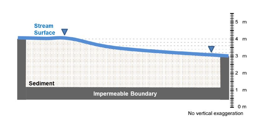
Give step-by-step solution with explanation and final answer:Bonus Points Opportunity (+15points) The figure below shows a cross-section along the thalweg of the riffle we saw in the Red Cedar River by the Hannah Administration Building (note: thalweg = the fastest flowing location in channel, usually near center of river). The head at the river! is given by the elevation of the river surface itself (i.e., this is a constant head boundary condition), which is the same as at a water table (i.e., # = 2). The reach (section) of the stream is between two points where the stream runs over old concrete structures that prevent the flow of water in the subsurface. Between the concrete structures, the stream runs over coarse alluvial sediment. This alluvial sediment contains the hyporheic zone, which is the volume below a stream characterized by stream water flowing through the subsurface. The dashed horizontal lines are elevations. Here, K = 1 x 10⁻³ m/s (and as implied by a single provided X value, X is isotropic and homogeneous throughout the sediment). a. Draw a quantitatively accurate flow net for groundwater flow in the sediment. Draw the equipotential lines as dashed lines, and the streamlines as solid lines. Show flow direction arrows on the streamlines. 5m Stream surface VW 2 4m E i i Rem amanm,: - 3m i 2m Sediment = fii BE i i 1 Impermeable Boundary m om No vertical exaggeration
Question:
Give step-by-step solution with explanation and final answer: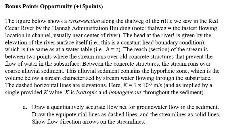
 Bonus Points Opportunity (+15points)
The figure below shows a cross-section along the thalweg of the riffle we saw in the Red
Cedar River by the Hannah Administration Building (note: thalweg = the fastest flowing
location in channel, usually near center of river). The head at the river! is given by the
elevation of the river surface itself (i.e., this is a constant head boundary condition),
which is the same as at a water table (i.e., # = 2). The reach (section) of the stream is
between two points where the stream runs over old concrete structures that prevent the
flow of water in the subsurface. Between the concrete structures, the stream runs over
coarse alluvial sediment. This alluvial sediment contains the hyporheic zone, which is the
volume below a stream characterized by stream water flowing through the subsurface.
The dashed horizontal lines are elevations. Here, K = 1 x 10⁻³ m/s (and as implied by a
single provided X value, X is isotropic and homogeneous throughout the sediment).
a. Draw a quantitatively accurate flow net for groundwater flow in the sediment.
Draw the equipotential lines as dashed lines, and the streamlines as solid lines.
Show flow direction arrows on the streamlines.
5m
Stream
surface VW
2 4m
E i i Rem amanm,: - 3m
i 2m
Sediment = fii BE i i
1
Impermeable Boundary m
om
No vertical exaggeration
Asked by: Yatin
Created at: 2025-09-06 17:32:04
Final Answer:
📢 Instructions:
- Ask anything relatd to above question only.
- For new Question goto :